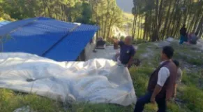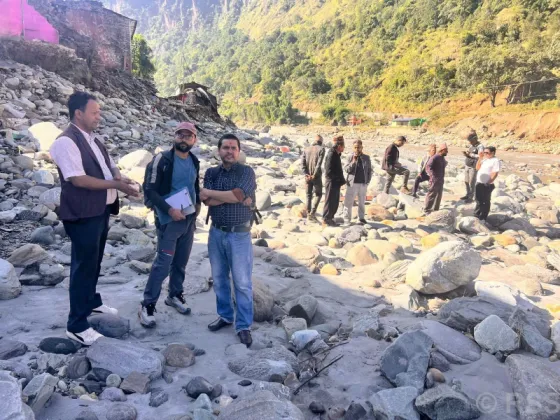
A geological study is being carried out in the disaster-affected settlements of Jaljala, focusing on the areas hit by landslides and on the geological conditions behind the disaster. The study covers the landslide-prone settlements of the area and is intended to establish why the slopes failed and how vulnerable nearby communities remain, according to a report published by Nepal Lead. Reported as a disaster, environment and science-related news event, the work comes at a time when the affected settlements are still living with the consequences of the landslides and when questions about the safety of the ground beneath them remain open.
Study spans affected and at-risk settlements
According to the report, the study is centered on the settlements that were directly affected by the landslides. Its scope, however, is not limited to the immediate disaster sites: it also extends across the wider landslide-prone settlements of the Jaljala area, examining the geological situation of the terrain on which these communities stand.
That wider scope matters because landslides rarely occur in isolation. The slopes, soils and drainage patterns that failed in one settlement can pose similar dangers to villages nearby, particularly where the geology is comparable. By studying both the disaster-affected locations and the surrounding area, the study is expected to build a broader picture of where the ground is stable, where it is under stress, and where future slope failures could occur.
The main questions the study addresses, as described in the report, are:
- The geological conditions that lay behind the landslide disaster in the affected settlements
- The state of the settlements that were directly hit by the landslides
- The exposure of the other settlements in the area that sit within landslide-prone terrain
Reading the ground beneath the villages
Geological studies of landslide-affected areas typically involve detailed field examination of the slopes in question: the strength and condition of the soil and rock, the steepness of the slopes, the way water moves through the ground, and any signs of continuing movement. Work of this kind is generally carried out before major decisions are made about reconstruction, relocation or mitigation in a disaster-hit area.
Understanding the geology behind a landslide is considered essential because it separates the underlying causes from the immediate trigger. In Nepal's hills, heavy rainfall often triggers slope failure, but whether a particular slope actually gives way depends on deeper factors, including the character of the rock and soil, the angle of the slope and the path water takes through it. Documenting those conditions provides an evidence base for judging whether the affected ground remains dangerous and whether nearby slopes could fail under similar conditions.
Landslide risk in Nepal's hill settlements
The study in Jaljala takes place against a familiar national backdrop. Nepal's steep terrain, fragile geology and intense seasonal rainfall make landslides one of the country's most recurring natural disasters, particularly during and after the monsoon. Settlements built on or below steep slopes are especially exposed, and hill communities across the country have repeatedly seen homes, farmland and infrastructure damaged when slopes fail.
In such a setting, geological assessment of disaster-affected settlements has become an important part of the response to landslide events. Rather than relying only on visible damage, the underlying geology is used to determine whether it is safe to rebuild in place, whether households should move to safer ground, and which parts of a landscape require treatment before the next heavy rains. The work in Jaljala fits within this broader approach to disaster risk reduction, in which the science of the terrain informs the decisions that follow a disaster.
From assessment to safer settlements
Studies of this kind are generally expected to inform a range of follow-up measures. Their findings can guide:
- Whether homes and settlements can safely remain on the affected ground or should be relocated to safer locations
- Where mitigation measures, such as drainage management or slope stabilization, may be needed across the landslide-prone area
- How future construction and land use should be planned so that new risks are not created in vulnerable terrain
For the residents of Jaljala's disaster-affected settlements, the findings carry practical weight. The safety of a house, the viability of farmland and the decision to stay or move can all hinge on what the geology reveals. The fact that the study covers not only the landslide-hit settlements but also the wider landslide-prone area means its conclusions could matter to communities that were not directly struck this time but share the same terrain.
Awaiting the findings
The report describes the study as work in progress, being carried out across the affected and landslide-prone settlements of Jaljala. Its conclusions are therefore yet to be made public. When they are, they are expected to serve as a reference for those responsible for managing disaster risk in the area and for the residents of the settlements themselves, offering a technical grounding for decisions on rebuilding, relocation and protection.
For now, the study is a reminder that responding to a landslide disaster does not end when the immediate emergency passes. Examining the geology of the affected and at-risk settlements is a step toward ensuring that the next spell of heavy rain does not catch the communities of Jaljala unprepared. Further details are available in the original report by Nepal Lead.