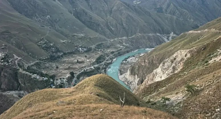
A proposal has been put forward to expand the strategic Karnali Corridor into a four-lane blacktopped road within five years, an ambitious plan for one of Nepal's most important north-south trade routes linking India and China. The corridor stretches approximately 505 kilometres, running from Jamunaha on the southern border through Nepalgunj, Kohalpur and Surkhet to Hilsa, the border crossing point with China. The plan has been reported by Pradeskhabar and Global Aawaj, although, despite the proposal, implementation has not yet begun.
A 505-kilometre artery from border to border
The Karnali Corridor is designed as a single, continuous alignment that begins at Jamunaha in the southern plains and climbs north through demanding terrain before reaching Hilsa on the Chinese frontier. Along the way it passes through the major urban and commercial centres of Nepalgunj, Kohalpur and Surkhet, which serve as the corridor's principal hubs.
At a glance, the proposal covers the following key elements:
- Length: approximately 505 kilometres from end to end
- Route: Jamunaha to Nepalgunj, then on through Kohalpur and Surkhet to Hilsa
- Standard: four-lane blacktopped road
- Timeline: targeted for completion within five years
- Strategic role: a north-south corridor linking India and China
The route's two ends give it particular weight. At its southern end, the corridor connects toward India through Jamunaha and Nepalgunj, while at its northern end it arrives at Hilsa, the crossing point into China. That makes the corridor one of the few continuous road alignments in the country that could, in principle, serve as a trade artery running from one international border to the other.
A four-lane blacktopped surface would also represent a significant step up in capacity for a route of this length, replacing the current alignment with a modern highway standard across its full 505-kilometre span.
Connecting the Himalayan hinterland
Beyond its cross-border function, the corridor is envisioned as a lifeline for the remote Himalayan settlements of the Karnali region, which have historically remained outside the mainstream of the national road network. By tying these areas into the same alignment that serves the southern plains, the project aims to bring isolated communities into closer contact with markets, services and administrative centres along the route.
This dual purpose, serving international trade and domestic connectivity at the same time, is central to how the corridor has been conceived: as a route whose benefits would flow both across the borders and within the communities it passes through.
What the upgrade is expected to unlock
The proposal frames the four-lane expansion as more than a road-widening exercise. It is expected to open prospects in three broad areas:
- Trade: as a north-south route joining the Indian border in the south to the Chinese border at Hilsa in the north, the corridor is positioned as a trade artery with the potential to move goods across the full width of the country.
- Tourism: improved access through Nepalgunj, Kohalpur and Surkhet toward the high Himalayan reaches of Karnali is expected to create prospects in tourism by making the region's remote destinations easier to reach.
- Hydropower: the corridor is also expected to open up prospects in hydropower, adding an energy dimension to the route's economic potential.
Together, these three strands form the economic rationale behind the proposal: a single 505-kilometre spine that would simultaneously serve cross-border commerce, everyday mobility for Karnali's remote settlements, and the development of the region's tourism and hydropower potential.
From proposal to blacktop: the implementation test
For all its ambition, the project remains, for now, a proposal. Implementation has not yet begun, and no work has started on turning the plan into an operational four-lane highway.
That gap matters, because the five-year completion target is measured from the start of construction. Until implementation begins, the timeline remains an aspiration rather than a schedule, and the distance between the two is the measure that will determine whether the corridor's promised benefits arrive on time.
For the communities and economic sectors the corridor is meant to serve, the significance of the announcement lies in what happens next. The proposal identifies the route as one of strategic importance: it links two international borders, threads together the commercial hubs of Nepalgunj, Kohalpur and Surkhet, and reaches into the remote Himalayan settlements of Karnali that have long awaited integration into the national road network.
The focus now shifts to how the proposal is translated into action, from the start of work on the ground to the delivery of the four-lane standard along the full route. If the five-year vision holds, the Karnali Corridor would emerge as a completed, blacktopped four-lane artery connecting Jamunaha and Nepalgunj in the south to Hilsa in the north, with trade, tourism and hydropower prospects attached to every kilometre in between.
Read the original reports
Further details on the proposal are available in the original coverage: